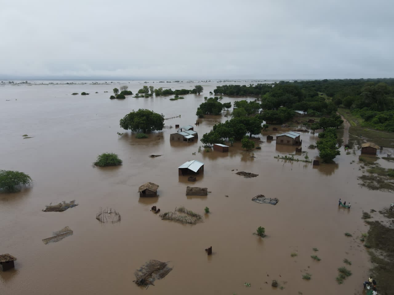
BLANTYRE, Malawi:On the night of March 13, 2023, when Cyclone Freddy hit Malawi, Celina Nyozani, a mother of eight, escaped the floods with the assistance of Lapken Thole, who had found a way to protect his family from the torrential downpours.
Nyozani told Africa Climate News that by the third day, she had become too hungry and frail to cling to the tree branches she had been clinging to.
“I and my eight children would have been swept away if it hadn’t been for Thole because the tree we were clinging to collapsed after we got into the boat,” she recalls.
“I spent $52 (Kwacha 54 thousand) to hire an engine boat for three trips to ferry 57 people from trees to higher ground at Mtondo Temporary Evacuation Camp,” Thole, 29, says.
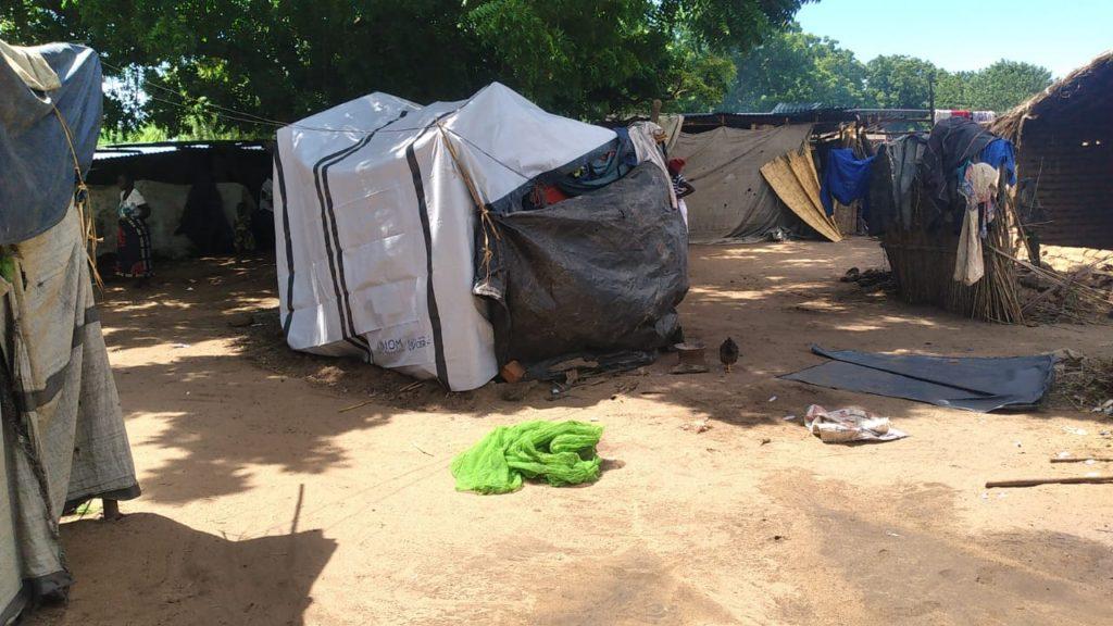
A week after the cyclone, approximately 2 700 households arrived at the camp but received no assistance. They were surviving on boiled livestock that the floods had killed.
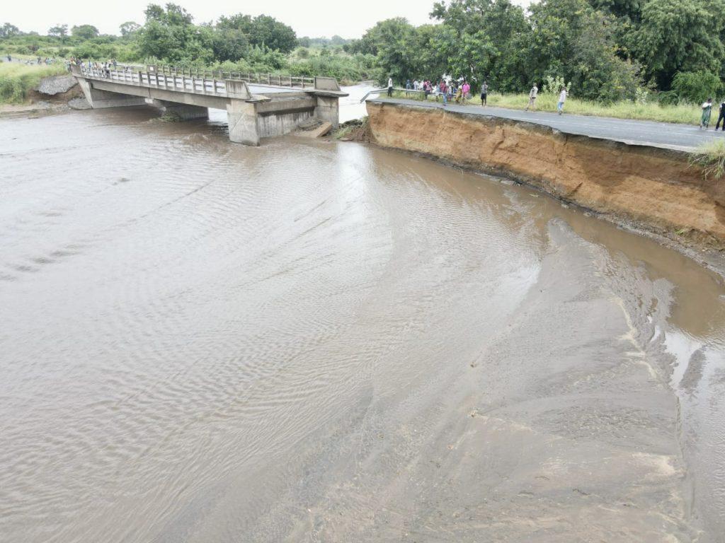
One of the worst-hit places was Njema in the Mulanje District, near Mozambique’s border. Survivors were stuck there for six days because the roads were closed.
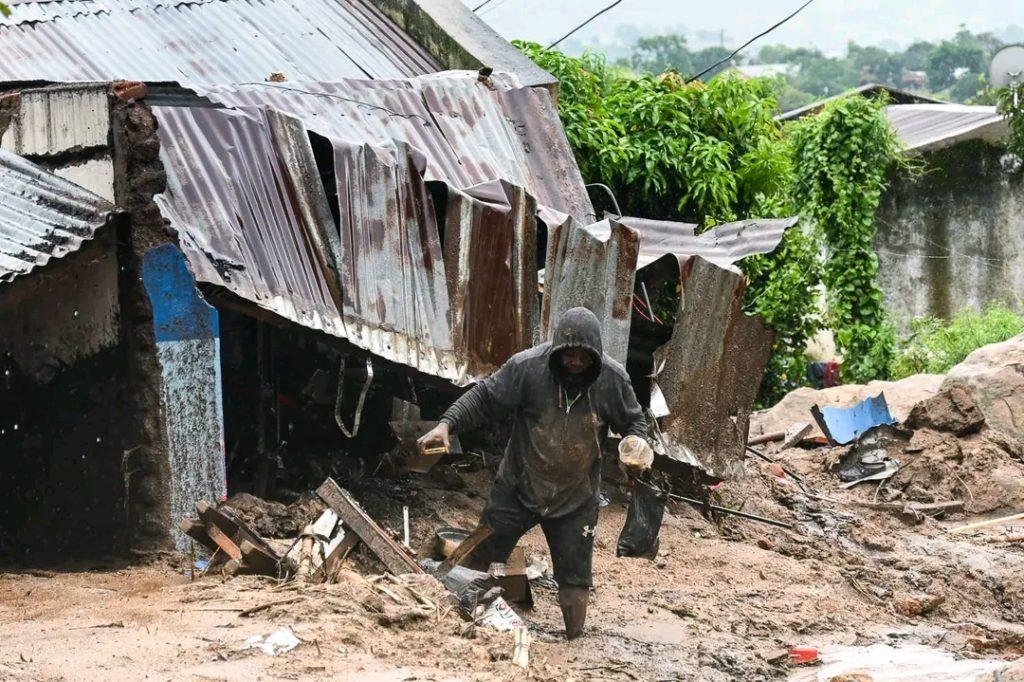
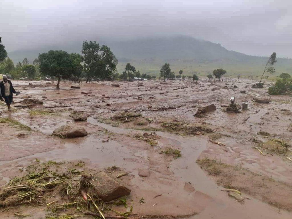
In Ntauchira Village, Chiradzulu District, about 20 kilometres northeast of Malawi’s commercial capital Blantyre, people were stuck for five days after mudslides from Chilimankhwanje Hill buried their homes and buried family members in the mud.
A Malawi Air Force helicopter flew for the first time to aid survivors in evacuation camps on Friday, March 17 (six days later).
Cyclone Freddy caused much damage in Blantyre, Mulanje, Thyolo, Phalombe, Zomba, and Chiradzulu, which are in the Nsanje and Shire Highlands districts.
The Shire highlands are bordered on the west and south by the Shire River valley, an extension of the African Rift Valley. The Shire River, Lake Malawi’s only outlet, is the largest in Malawi, flowing into the Zambezi River.
According to the World Meteorological Organization(WMO), Cyclone Freddy traveledover 8,000 kilometersacross the entire South Indian Ocean. Storm surges, damaging winds, and heavy rainfall affected sizable portions of Malawi, Mozambique, Northeast Zimbabwe, and Southeast Zambia.
According to the WMO, southern Mozambique received more than a year’s rain. Madagascar received three times the monthly averagein aweek.Malawi received six months of rain in six days, according to the World Food Programme (WFP).
Also read how past floods have reversed decades of development in Malawi.
The president of Malawi declared a disaster in the Southern Region, which includes the districts of Blantyre, Chikwawa, Neno, Nsanje, Chiradzulu, Mulanje, Mwanza, Phalombe, Zomba, and Thyolo.
The violent flood and strong winds caused mudslides that cut off access to many areas, destroyed crops and homes, and buried people in mud and debris.
When the rains stopped, the death toll had risen to over 500 people by the sixth day. According to the Department of Disaster Management Affairs (DODMA), over 500 people have gone missing, and over 1300 have been injured across ten districts. Over 550 000 displaced households are being housed in 505 camps.
Isn’t early warning taken seriously?
The Department of Climate Change and Meteorological Services (DCCMS) of Malawi warned on March 7, 2023, that a tropical cyclone was coming.
“The cyclone is expected to move further south into Malawi on Saturday or Sunday. The cyclone’s predicted path includes the districts of Mulanje, Phalombe, Chiradzulu, Thyolo, Zomba, Blantyre, Neno, Mwanza, Nsanje, and Chikwawa. From Friday, damaging winds, torrential rains, and flooding are all possible risks in the highlighted areas”. Part of the statement is read.
The department told the Malawi people to check their buildings’ stability and strengthen them as needed. In addition, the advisory required people to make evacuation plans for houses that were not strong enough, clear waterways, and avoid crossing rivers. It also warned of the dangers of collapsing homes, pit latrines, and power lines. DCCMS also requested that the likely affected district councils notify civil protection committees to assist people in moving to safe areas.
Buthand, people in Blantyre, Chiradzulu, Phalombe, Mulanje, and Thyolo ignored the warningsas disasters rarely hit these areas.
“Because the districts of Nsanje and Chikwawa are prone to flooding. People did not disregard the warnings: “The rains were simply too heavy,” “Dorothy Tembo-Nhlema, a disaster expert and environmentalist, told Africa Climate News.
Why should Africa mine its natural gas?
By the end of 2022, the disaster department had dredged some rivers prone to flooding due to siltation and debris to reclaim river depth and built dikes in some villages in Nsanje and Chikwawa.
The National Civil Society Network on Climate Change coordinator, Julius Ng’oma, told Africa Climate News that it was commendable that meteorological departmentissued the early warning on time. However, the warning was insufficient. “With high poverty levels in the worst-affected areas, it was difficult for people to move to safe places or reinforce their structures,” Ng’oma explains.
The government’s preparedness could be improved.
Seven major cycloneshave hit Malawi since January 2019. Concerns have been raised about how ready and able Malawi’s government is to deal with disasters because of how they handled Cyclone Freddy.
According to Ng’oma, Malawi’s disaster preparedness could be improved.
“We are still relying onan old1991 Act, which isn’t helping matters. It only focuses on response, and we lag behind because we rely on donors and development partners.”Ng’oma stated.
Two days after the disaster, on March 15, 2023, Malawi Defense Force (MDF) marines had to travel about 237 kilometers from their base in Mangochi District to Nkando in Mulanje District to help people who were stuck.
Although the deadly storm was expected to make roads impassable, no air response plans were made before the disaster. Harry Mkandawire, in charge of defense, said that bad weather made it impossible for the government to send MDF helicopters “on time.”
Even though cyclones are becoming more frequent and intense, disaster department spokesperson Chipiliro Khamula told Africa Climate News that the department is facing financial constraints in disaster management.“Recovery and intervention needs are greater than available resources,” Khamula said.
Ng’oma says that if the 2019 Disaster Risk ManagementdraftBill is passed, it will help prepare for, manage risks, and respond to similar events in the future.
The bill supposed to replace the Disaster Preparedness and Relief Act of 1991 is still in draft form ten years after the procedures were completed.
“This new law will be very important for setting up a detailed response budget, making it easier for communities to deal with and prepare for disasters, strengthening eco-systems, and reducing poverty so that people can act quickly,” says Ng’oma.
Why have the Shire Highlands been the hardest hit?
The recently releasedUN scientific reporton climate change is unequivocal.Human activity has caused global temperatures to rise by 1.1°C between 2011 and 2020, exceeding the pre-industrial level.
“Those who have made the least contribution to climate change are the most vulnerable to its consequences.” People in highly vulnerable areas are up to 15 times more likely to die in floods, droughts, and storms (when compared to those in the most resilient areas),” said Hoesung Lee, Chair of the Intergovernmental Panel on Climate Change (IPCC), during a press briefing.
Yobu Kachiwanda, in charge of public weather services for the meteorological department, says that the Shire highlands are at risk of cyclones because they are close to the Indian Ocean, where cyclones form and get stronger.
Kachiwandafurthersays that the region is more likely to be hit by cyclones because the land is getting worse, people are moving to places that weren’t planned, and infrastructure is being built without considering what the climate will be like in future.
“The country should brace itself for more dangerous weather as an average of nine tropical storms form in this part of the ocean,” Kachawinda warns.
Tembo-Nhlema says that the large amount of environmental damage in the highlands created a considerable risk because there were no trees to control the water. The shallow rivers made it easy for mudslides and floods to happen.
Encroachment and illegal settlements in 2013by 63 households in the Soche Hill forest reserve (a protected area in Blantyre City) caused such degradation.The Blantyre City Council had ordered the encroachers (now over 1,000 households) to leave, but a 2017 court injunction prevented them from leaving the flood-prone area. The Soche Hills illegal settlement had the highest number of deaths following Cyclone Freddy.
Malawi Vice President Saulos Chilima described the decision to stay as a death trap.
But for now, in the middle of a cholera outbreak made worse by floods, Thole can only hope that the broken water systems and pit latrines will be fixed quickly so that people can get clean water and have better sanitation.
“Aside from providing us with shelter and food, deliberate efforts should also be made on water, sanitation, and hygiene, or else cholera will wipe us out,” he says.
The post As cyclones persist, how prepared is the government of Malawi? appeared first on Africa Climate News.
